There is a pattern that shows up every time we start drawing a wine region at the studio. Before the first grape name is written, four things are already on the paper: a river, a slope with a direction, a handful of anchor towns, and a border where the climate begins to argue with the vine. Bordeaux sits between the Garonne and the Dordogne. Burgundy leans against the Saône. Champagne is chalk hills north of the Marne. Alentejo spreads east from Évora across the Guadiana. "Wine country," read honestly, is a geographic sentence in four clauses.
The River Is Never Decoration: Why Wine Country Follows Water
There is a pattern we notice every time a new region lands on the drafting table: the river came first, and the wine came because of it. Not near it. Not alongside it. Because of it.
Look at what happens when you strip the labels off a map of the four regions above and leave only the hydrology. Bordeaux is not a city that happens to sit near two rivers; it is the point where the Garonne and the Dordogne meet, and the vineyards distribute themselves around that meeting like iron filings around a magnet. The Médoc runs along one bank because that bank exists in the shape it does. Saint-Émilion sits above the Dordogne because the Dordogne cut the shelf it stands on. When we draw Bordeaux, we draw the water first and the appellations arrange themselves almost without our help.
Burgundy is a stranger case, because the river that made it — the Saône — is not the river people think of when they think of Burgundy. The famous slope, the Côte d'Or from Dijon down through Beaune to Nuits-Saint-Georges, is a fault escarpment that runs parallel to the Saône valley. The river did not carve the slope; the slope exists because the valley exists, and the valley exists because the river spent a very long time being a river. The vines are on the slope, but the slope owes the Saône an apology it will never pay.
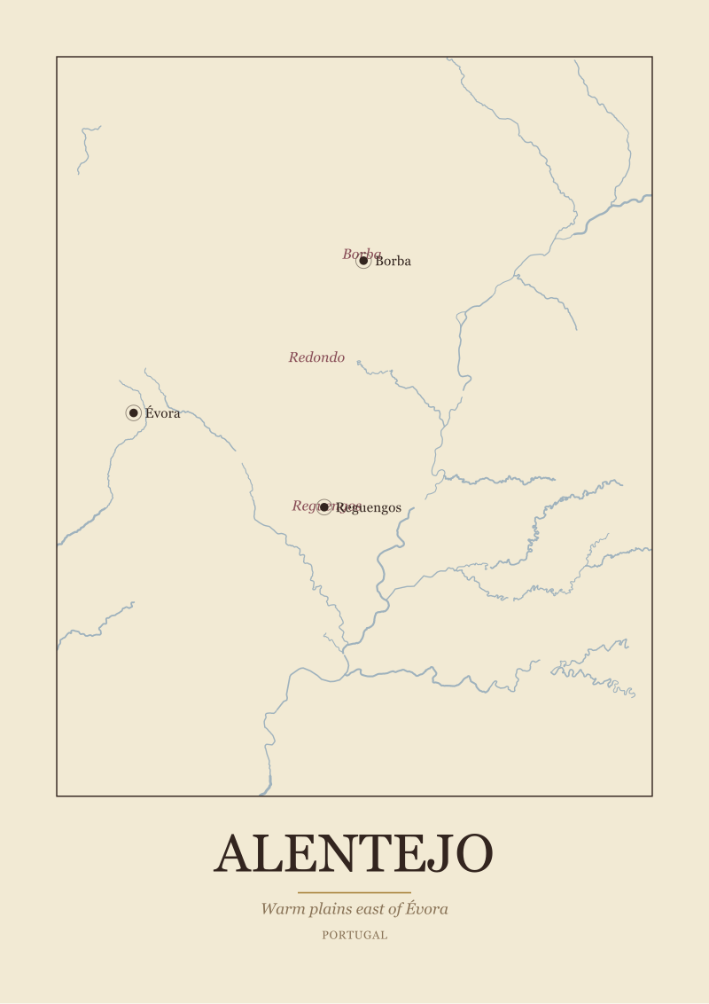
Champagne behaves the same way with the Marne. The name "Vallée de la Marne" is not tourism copy; it is a sub-zone designation, one of the three legs on which the region stands with the Montagne de Reims and the Côte des Blancs. Alentejo, further south and much drier, uses the Guadiana the way an arid country always uses its rivers: as the axis around which everything else — including Évora, Reguengos and Borba — negotiates its distance from water.
The rule that emerges is not romantic. Rivers cut valleys. Valleys expose slopes. Slopes drain, warm, and orient. Everything the wine industry later calls "terroir" begins as a consequence of the fact that water moves downhill and, over enough centuries, rearranges the ground it moves through. When we say "wine country follows water," we mean it geologically, not scenically.
The Slope Has an Address: Orientation as the Silent Rule
There is a second pattern, quieter than the first, that only becomes visible once the river is on the page. The vineyards do not spread evenly across both banks or all sides of a hill. They cluster. They choose. They have, in the literal cartographic sense, an address — a compass direction they face.
Burgundy is the clearest textbook case in Europe. The Côte d'Or is a slope that faces broadly east. That single fact — a wall of hillside catching morning sun as it comes up over the Saône plain — organises the entire region. The Côte de Nuits and the Côte de Beaune are two chapters of the same essay: an east-facing escarpment reading light from the moment the sun clears the horizon. If the slope faced west, Beaune would be a town people passed through on the way to somewhere else.
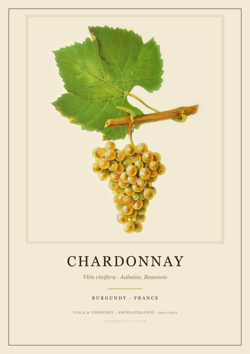
Champagne repeats the lesson with a colder accent. The Montagne de Reims is not a mountain; it is a plateau whose flanks catch sunlight from different sides, and the growers have known for centuries which flanks ripen and which do not. The Côte des Blancs, further south, is another oriented slope, this one famous for chardonnay because chardonnay does something specific on chalk that faces the sun a specific way. Aÿ, on the Marne itself, exists as a village name in the classification because of how its particular hillside sits with respect to river and light.
Bordeaux is subtler because Bordeaux is flatter, but the same logic runs underneath. The Left Bank of the Garonne — the Médoc, Graves — and the Right Bank around Saint-Émilion are not two different regions because of a folk tradition. They are two different regions because water, sun and soil arrange themselves differently on each side of a river the size of the Garonne. Alentejo, which is warm and open where Champagne is cold and pinched, uses orientation in reverse: the question there is not how to catch every scrap of sun but how to survive it, and the subzones of Borba, Redondo and Reguengos each answer that question with their own hillsides, their own exposures, their own compromises with heat.
Wine country is the place where a slope has been asked, for long enough, to remember which way it faces.
 Bordeaux
The print from this article · from €29.95
View the print →
Bordeaux
The print from this article · from €29.95
View the print →
The Anchor Town Names the Region, Not the Vineyard
The third pattern is easy to miss because it hides inside the vocabulary. Wine regions, when they are honest about themselves, are named for towns, not for grapes and not for estates. The town is the anchor. The town is what the region orbits.
Bordeaux is Bordeaux because Bordeaux is a city. It has been a port on the Garonne long enough that English merchants had a stake in its trade in centuries when most of Europe was doing something else. Saint-Émilion is Saint-Émilion — a village, a Romanesque monolithic church, a set of streets — and the appellation borrowed the village's name because the village came first. Pauillac is a small commune on the Médoc side of the estuary; the châteaux clustered around it inherited its address rather than the other way round.
Burgundy is even more explicit about this. The route through the Côte d'Or reads like a gazetteer: Dijon at the top, Beaune in the middle, Nuits-Saint-Georges further south. The great climats of the region are named for the villages they surround. This is not decoration; it is a genuine cadastral fact. When we draw a Burgundy print at the studio, the villages carry the map. The vines are inferred from where the villages are and which way the hills lean behind them.
Champagne organises itself around Reims and Épernay, with Aÿ as a signature hyphen between them. Reims is the cathedral city; Épernay is the trade capital; Aÿ is a village whose name has meant something specific in the region's classification for a very long time. Alentejo, less familiar to non-Iberian readers, works the same way: Évora is the historic anchor, a walled town on a rise, and the subzones — Borba, Redondo, Reguengos — are all named for the towns they contain, not for the grapes they grow.
The reason this matters is practical, not sentimental. When a region is named for its towns, the map you draw of it makes sense at every zoom level. Zoom out and you see a country with a shape. Zoom in and you see a road, a square, a church. Zoom in further and you see a hillside behind the church that faces the right way. The town is the joint between the human scale and the geographic scale — the piece of the region a visitor can actually stand in. Regions named for grapes lose that joint. Regions named for brands never had one.
The Cold Edge: Why the Best Wine Country Sits Where Grapes Almost Fail
The fourth pattern is the one we come back to most often at the studio, because it is the one that non-drinkers tend to find most surprising: the most storied wine country in Europe sits at the climatic edge, not in the climatic middle.
Champagne is the extreme case in our four. It is a region defined by chalk hills north of the Marne, at a latitude where grapes barely ripen in a normal year. The whole architecture of Champagne production — the blending across villages, the long ageing, the fact that the wine is deliberately made from a base that would be austere as a still wine — is a set of technical answers to a geographic problem: you are growing vines at the northern edge of where vines will grow at all. The chalk hills do part of the work by storing warmth and drainage. The rest is human patience against a cold border.
Burgundy is not as cold as Champagne but sits far enough north that its great years are the ones where the ripening finished. That is why the east-facing slope of the Côte d'Or matters so much. Every extra hour of morning sun in September is a hedge against a season that could tip either way. The region's reputation is built, in part, on the fact that it operates without a comfortable margin — its best expressions come out of vintages where the geography did just enough.
Bordeaux and Alentejo sit on the warmer side of the argument, but the same logic reappears in mirror. Bordeaux has an Atlantic edge; the maritime climate is what protects it from the extremes, but that same climate produces vintages where the grapes did not ripen the way growers wanted. The estuary is a moderating hand, but a moderating hand still lets some years go cold. Alentejo runs the opposite risk: it sits in the hot interior of southern Iberia, and the geographic challenge is heat and drought rather than cold. Its edge is the other edge, but it is still an edge. The Guadiana and the altitude of the subzones do the same job the chalk does in Champagne — they moderate an extreme.
The pattern, stated plainly: wine country is the geography that sits close enough to a limit that the limit is visible in the wine. Regions in the comfortable climatic middle produce fruit easily and produce reputations rarely. Regions at the edge produce trouble routinely and produce identity because of the trouble.
 Champagne
The print from this article · from €29.95
View the print →
Champagne
The print from this article · from €29.95
View the print →
So What Do You Actually Do With This
You use it to stop reading wine regions through their grapes and start reading them through their maps. When you next see the name of a wine region, ask four questions in order: which river, which slope, which town, which edge. If you can answer all four for a given region, you know it in the way we try to know it before we draw it. If you cannot, the region is still a name; it is not yet a place.
For the four we have used here, the exercise is short. Bordeaux: Garonne and Dordogne, Left Bank and Right Bank, city of Bordeaux with Saint-Émilion and Pauillac as satellites, Atlantic maritime margin. Burgundy: Saône to the east of the escarpment, east-facing slope of the Côte d'Or, Dijon and Beaune and Nuits-Saint-Georges as the axis, northern ripening edge. Champagne: Marne through a chalk landscape, Montagne de Reims and Côte des Blancs and Vallée de la Marne, Reims and Épernay and Aÿ, extreme northern edge. Alentejo: Guadiana across a warm plain, subzones of Borba and Redondo and Reguengos around Évora, southern heat edge. Each is a sentence with four clauses. Each sentence is what makes the region legible.
And if you find yourself wanting the sentence on paper — the river, the slope, the towns, the border — that is exactly the kind of map we draw at the studio. Our /shop/ carries prints of the same regions read the same way, one geographic sentence at a time.
FAQ
Is "wine country" a formal geographic term or a colloquial one?
It is colloquial rather than legal. There is no cartographic convention that defines "wine country" as a category the way "watershed" or "appellation" are defined. What exists formally are appellation systems — AOC in France, DOC in Portugal, and their equivalents — which draw legal borders around specific regions. "Wine country" is the informal umbrella under which those legal borders make sense to a general reader.
Why do so many famous European wine regions sit on rivers?
Because rivers do the geological work that vines later benefit from. A river carves a valley over time, and the valley walls expose the slopes and soil profiles — chalk in Champagne, gravel and clay around the Garonne, schist and granite elsewhere — that let vines root, drain and orient toward sunlight. The river is also historically the trade route that let a region's wine reach a wider market before roads or rail existed.
Does slope orientation really matter that much for wine regions?
In cool climates it is decisive. The Côte d'Or in Burgundy is famous partly because its main slope faces broadly east and catches morning sun, adding ripening hours in a latitude where every hour counts. In warmer regions such as Alentejo the question inverts — orientation is used to manage excess sun rather than capture scarce sun — but it is still a design factor that growers and mapmakers pay close attention to.
Are wine regions always named after towns?
The most durable ones tend to be. Bordeaux, Reims, Épernay, Évora and the villages of Burgundy anchor their regions because towns give a region a human scale and a fixed cartographic point. Regions named primarily for grape varieties or brands often blur at the edges because they lack that anchor. The town-name convention is why appellation maps read as maps at all rather than as marketing overlays.
Why is Champagne grown so far north if it is such a cold place for vines?
Because the cold is the point. Champagne sits at a latitude where grapes struggle to ripen fully, and that struggle produces the high-acid, low-alcohol base wine that the region's production method turns into sparkling wine. The chalk soils store warmth and drain well, which partially compensates. The style would not exist in a warmer place; the geography is what forces the technique.
What is the difference between Bordeaux's Left Bank and Right Bank?
They are the two sides of the Gironde estuary and its tributaries — the Left Bank stretching along the Médoc and Graves to the west of the Garonne, the Right Bank around Saint-Émilion and Pomerol along the Dordogne. The distinction is geological before it is stylistic: the soils, drainage and exposure differ meaningfully between the two banks, and those differences shaped which grape varieties took root where.
Where does Alentejo fit in relative to the more famous French regions?
Alentejo is Portugal's warm inland wine country, spreading east from Évora across the Guadiana river through subzones such as Borba, Redondo and Reguengos. Geographically it belongs to a different family than Bordeaux, Burgundy or Champagne — the challenge is heat and dryness rather than cold — but the underlying reading is the same: a river, a set of anchor towns, subzones with their own character, and a climatic edge that shapes the wine.
How should someone read a wine region map for the first time?
Ignore the grape names on the first pass. Trace the rivers, note where the anchor towns sit relative to those rivers, and look for which way the significant slopes are turned. Then look at the outer border of the region and ask what makes it a border — usually a change in altitude, soil, or climate. Once those four layers are legible, adding the grape varieties back on top makes the region make sense as a place rather than as a list.

New regions and 10% off your first print.
One email now with your code. No noise after.