Pull up the first ten "wine lover gift map" results and read them as a receipt, not as inspiration. Bordeaux appears without the Garonne. Burgundy appears without the Saône. Champagne appears without the Marne. Alentejo, when it appears at all, floats east of Évora with no Guadiana cutting through it. Four regions, four rivers, and on most of these prints the rivers are gone. Hear me out: a wine region map that erases the river is not a wine map. It is a label in the shape of a country, and the person who actually loves wine will notice within about four seconds.
What the Receipt Actually Says: Four Regions, Four Rivers, Zero Mention of Them
Line the four most-gifted European wine regions up as a plain inventory and the pattern is almost comic.
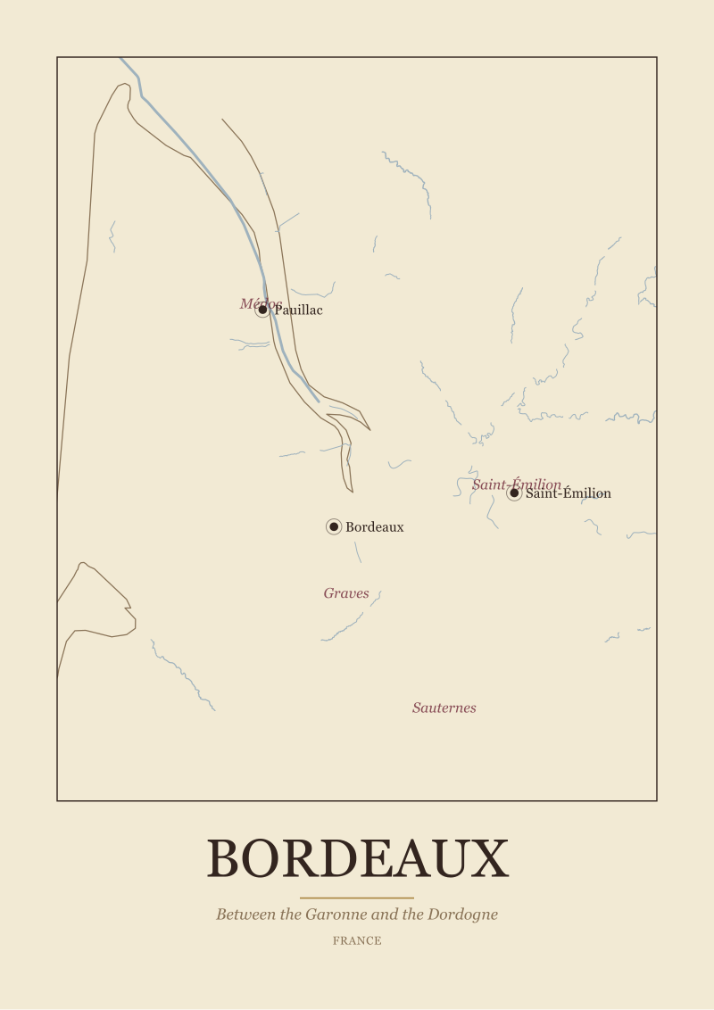
Bordeaux, in France, is a region defined by sitting between two rivers that meet at an estuary. The Garonne runs through the city of Bordeaux itself; the Dordogne comes in from the east; the two converge into the Gironde and empty into the Atlantic. Pauillac exists where it exists because of the Garonne. Saint-Émilion exists where it exists because of the land on the far bank. Remove the water, and you have removed the reason the sub-zones are where they are.
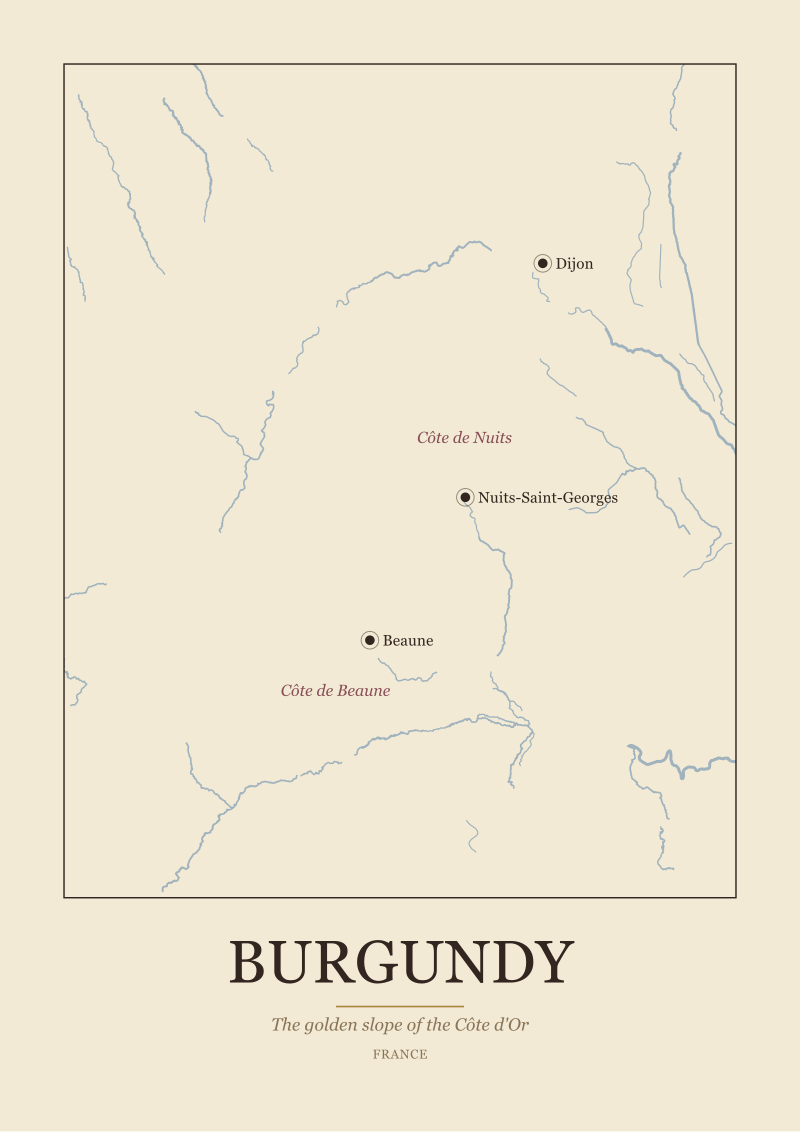
Burgundy, in France, is a region defined by a slope. The Saône runs north–south, and the great east-facing escarpment of the Côte d'Or runs parallel to it, from Dijon in the north through Beaune and down into Nuits-Saint-Georges. The Côte de Nuits and the Côte de Beaune are not administrative inventions. They are two halves of the same hill, read by anyone who has ever driven the Route des Grands Crus. Delete the Saône from the map and you have deleted the reference line that tells you which way the slope faces.
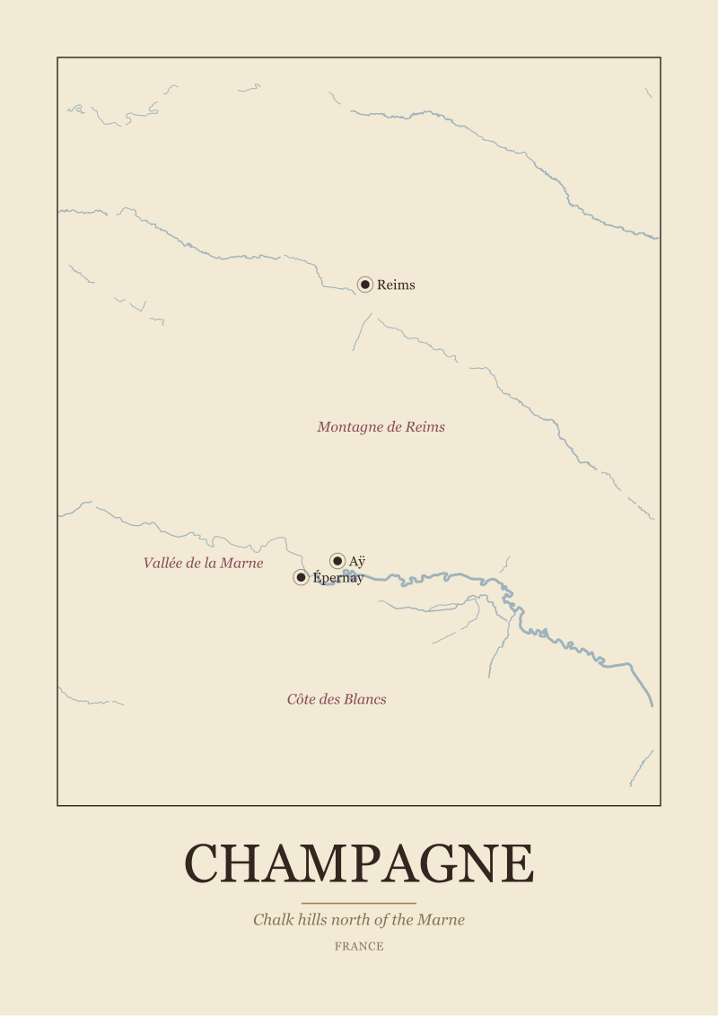
Champagne, in France, is a region defined by chalk and by the Marne. The anchor towns — Reims, Épernay, Aÿ — sit on, above, or just across from that river. The Montagne de Reims is north of it. The Vallée de la Marne follows it. The Côte des Blancs falls to the south. The river is not a decorative squiggle; it is the orientation device that tells you where the three great sub-zones live.
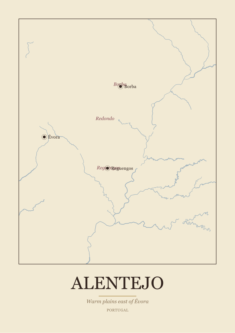
Alentejo, in Portugal, is a region defined by the warm plain east of Évora and the slow course of the Guadiana. Borba, Redondo, and Reguengos arrange themselves across that plain in a way the Guadiana explains. Lift the river, and Évora becomes a town floating in beige.
Four regions. Four rivers. On the gift maps you can buy right now, those rivers are present on perhaps one in ten.
What the Numbers Actually Say About Wine Region Maps
The industry marketing the "wine lover gift map" category is remarkably open about what it is actually selling. Read the product copy on the top results and you find a specific, repeated vocabulary. "Decorative." "Minimalist." "Boho." "Vintage-feel." "Rustic farmhouse." "Perfect wall art for the wine lover in your life." What you do not find, almost ever: the name of the river that defined the region on the map.
That is the receipt. It is not an accusation. It is a product-category disclosure, written by the sellers themselves.
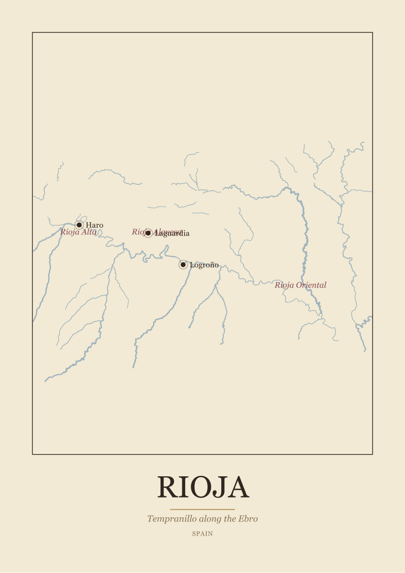
The deletion is deliberate. If the product is "wall art that signals wine," then rivers are visual noise, borders are visual noise, sub-zones are visual noise, and what remains is a country silhouette with a few serif-font words floating on top of it. France becomes a hexagon with the word *Bordeaux* near the southwest. Portugal becomes a long rectangle with *Alentejo* somewhere in the middle. Spain becomes a square with *Rioja* floating north. The map is doing no work. The country silhouette is doing all the work, and the country silhouette is doing work no wine region actually needs.
A region is not a country. Bordeaux is not France. Alentejo is not Portugal. The whole point of a wine region as a geographic unit is that it is smaller than, and shaped by, features that cut across political borders — a river, a mountain, a weather line, a soil change. The country silhouette is the one piece of geography that wine regions are least about, and it is the one piece these gift maps keep.
Then stack the numbers against the editorial reality. Bordeaux has four sub-zones in the public record used here — Médoc, Saint-Émilion, Graves, Sauternes — and each one maps onto a specific side of a specific river. Burgundy's two sub-zones in the record — Côte de Nuits, Côte de Beaune — are a slope divided roughly at Beaune. Champagne's three — Montagne de Reims, Vallée de la Marne, Côte des Blancs — read as three bearings off the Marne. Alentejo's three — Borba, Redondo, Reguengos — are a triangle in the plain. Each region's internal shape is legible only through its rivers and its towns. Delete those, and all four regions collapse into the same undifferentiated beige rectangle, labelled.
Which, more or less, is what the receipt shows.
 Bordeaux
The print from this article · from €29.95
View the print →
What Nobody Mentions: The Geography a Decorative Map Deletes
The silent trade in these products is a swap of information for mood. The seller is not lying; the seller is selling mood. The problem is that the buyer thinks they are buying information — specifically, a thoughtful, considered object that acknowledges the recipient's actual interest. The person who loves wine does not need a reminder that France exists. The person who loves wine is interested in the question of why Pauillac tastes like Pauillac and Saint-Émilion tastes like Saint-Émilion, and that question is answered by two things: the river between them and the gravel under one and the clay under the other.
A decorative gift map deletes both.
Consider Burgundy. The reason sommeliers refer to "the slope" is that there is, physically, one great east-facing slope above the Saône plain, and almost every parcel anyone has ever told a story about is on it. Vosne, Chambolle, Gevrey, Nuits-Saint-Georges, Beaune, Pommard, Volnay, Meursault, Puligny, Chassagne — those names are a vertical procession down a single hillside. A map that shows the Saône, shows the slope, and marks Dijon at the top and Beaune in the middle gives you the geographic engine of the region in a single frame. A map that shows "Burgundy" as a word stamped on a wine-coloured region of France gives you nothing.
Consider Champagne. The entire reason the region exists as a sparkling-wine region, not a still-wine region, is that grapes here barely ripen. Latitude, chalk, cool-climate autumns, river fog, a long slow second fermentation — all of this is geographic consequence. The Marne is where that climate lives. A map of Champagne that shows Reims, Épernay, Aÿ along the Marne, with the three sub-zones labelled correctly off it, tells the recipient something true about why their favourite bottle exists. A map that just writes *Champagne* in Belle Epoque script over northern France tells them the designer owns Illustrator.
Consider Alentejo. The warm plain east of Évora is one of the quieter revelations of Iberian wine geography — a region that is nothing like the Douro, nothing like Rioja, nothing like the greener, cooler country to its north. The Guadiana is the piece of information that places it. Without the river, Alentejo is a vague area in southern Portugal. With the river and with Évora, Reguengos, and Borba marked, it becomes a place.
Consider Bordeaux, finally. Left Bank and Right Bank are not metaphors. They are instructions for reading the map. Médoc north of the city on the left bank of the Garonne-into-Gironde; Saint-Émilion east, on the right bank of the Dordogne; Graves to the south of the city; Sauternes further south again where the cool Ciron meets the Garonne. A map without the rivers does not just lose detail; it loses the entire organising principle of the region. You cannot have a Bordeaux map without the rivers any more than you can have a London map without the Thames.
The Real Cost of Giving a Map That Does Not Know Its Own River
The dollar cost of the standard gift map is small. The real cost is a quieter one: the recipient looks at the map, says *oh, nice*, and files it in the mental category of "things people got me because they thought wine, not because they thought me." That is the gift that evaporates. It gets hung for a week in the kitchen, migrates to the hallway after six months, and ends up in a cupboard inside a year.
The alternative is not more expensive. It is not more complicated. It just requires that the map actually be a map of the region, not a mood board about the country containing it.
The test the recipient will apply, consciously or not, is simple. They will look at the print and ask: can I find the river? Can I find the town I visited? Can I trace the sub-zone whose wines I actually drink? If the answer to all three is yes, the map stays on the wall. If the answer to any of them is no, the map is decoration pretending to be meaning, and that is a specific and detectable kind of letdown.
A map of Bordeaux that shows the Garonne, the Dordogne, their confluence into the Gironde, and the four sub-zones in their correct geographic position passes the test. A map of Burgundy that runs the Saône down one side, marks the Côte d'Or escarpment running parallel, and names Dijon, Beaune, Nuits-Saint-Georges in their right places passes the test. A map of Champagne that shows the Marne curving east to west with Reims, Épernay, Aÿ anchored to it and the three sub-zones placed correctly passes the test. A map of Alentejo that shows the Guadiana cutting south, with Évora on the plain and Reguengos, Redondo, Borba as the three points of its sub-region triangle, passes the test.
None of these are hard to draw. They are just not what the gift-map industry draws, because the gift-map industry is drawing a country and writing a wine word on it, which is a much simpler and cheaper thing to make.
The additional cost of a map built from the actual geography — the river traced from a real public-domain hydrography source, the sub-zones placed where they are, the anchor towns in position — is zero to the recipient and modest to the maker. The returns are not modest. A map that gets the geography right earns the thing a decorative poster can never earn: the recipient reading it, and continuing to read it, for years.
That is what you are actually buying when you buy a wine map for someone who loves wine. Not a mood. A reading surface.
 Alentejo
The print from this article · from €29.95
View the print →
If You Only Remember One Thing
A wine region is defined by what cuts through it, not by the country that contains it. If the river is missing, the map has deleted the single piece of information the recipient actually wants to find.
So when you are choosing a wine lover gift map, read the image before you read the price. Find the river. Find the anchor towns. Find the sub-zones. If all three are present and placed correctly, you are giving a map. If any of them are missing, you are giving a decorated label — and the person who loves wine will know, quietly, which one you brought them. Our own map prints at the shop are built on exactly this test, because we draw the river first and the frame last.
Watch three things over the next few years in this category: (1) whether gift-map sellers start naming rivers in their product copy, which is a one-word tell that the geography is actually drawn; (2) whether sub-zone names (Médoc, Côte de Nuits, Vallée de la Marne, Reguengos) appear in listings beyond the single word *Bordeaux* or *Champagne*; (3) whether the source of the base geography is disclosed at all — public-domain hydrography layers exist, they are free, and the serious makers cite them. Those three signals tell you, before you even open the image, whether what you are looking at is a map or a mood.
FAQ
What should a wine region map actually show to count as a real wine map?
At minimum, three things: the main river or rivers that define the region, the anchor towns a wine reader would recognise, and the sub-zones placed in their correct geographic positions. For Bordeaux that means the Garonne, the Dordogne, their confluence, and the Médoc / Saint-Émilion / Graves / Sauternes layout. If a print shows only a country silhouette with the region name floating on it, it is a label, not a map.
Why does the river matter so much on a Bordeaux map?
Because the entire organising principle of Bordeaux is Left Bank and Right Bank, and those terms refer to specific banks of specific rivers. Médoc sits on the left bank of the Garonne-into-Gironde; Saint-Émilion sits on the right bank of the Dordogne; Graves and Sauternes anchor to the south. Without the rivers, Left Bank and Right Bank become meaningless phrases, and the region's sub-zone logic disappears from the frame entirely.
Is Burgundy really just one slope?
The Côte d'Or, which is the heart of fine Burgundy, is essentially a single east-facing escarpment running roughly from Dijon in the north through Beaune and down to Nuits-Saint-Georges. It is divided editorially into the Côte de Nuits (northern half) and the Côte de Beaune (southern half). The Saône plain lies to its east. A map that shows the Saône and the parallel slope captures Burgundy's engine in a single glance.
Why is Champagne tied so tightly to the Marne?
The Marne is the river the three sub-zones orient themselves around: Montagne de Reims to the north, Vallée de la Marne following the river itself, and Côte des Blancs falling to the south. The anchor towns — Reims, Épernay, Aÿ — all sit on or near it. Champagne is a cool-climate region where grapes barely ripen, and the river corridor is where that climate is at its most workable.
Where exactly is Alentejo in Portugal?
Alentejo is the warm plain east of Évora, running south from the Tagus region toward the Algarve. Its main river is the Guadiana, which crosses it on a slow southward course. The three sub-zones named in the public record used here — Borba, Redondo, Reguengos — form a loose triangle on the plain. A map of Alentejo that omits the Guadiana or Évora is omitting the two features that locate the region at all.
Are decorative "boho" wine maps bad gifts?
They are not bad gifts in the generic sense — someone who likes decoration will enjoy decoration. The argument here is narrower: for a person who actually loves wine, a map that erases the geographic features that define the region is a mismatch between what the gift signals (thoughtfulness about their interest) and what it delivers (country-shaped wall art). The gap is small, but detectable, and tends to show up in how long the print stays on the wall.
How can I tell before buying whether a wine map is drawn from real geography?
Look for three tells in the product listing. One: does the copy name the rivers, sub-zones, or anchor towns? Two: are those features actually visible in the preview image, not just in the description? Three: does the maker mention the geographic source for the base map (public hydrography layers, surveyed coastlines)? Sellers drawing from real sources tend to say so. Sellers who are not, tend not to.
Why does the Wine Map Prints desk care about rivers so much?
Because rivers are the single most honest geographic feature a wine region has. They do not move with marketing, they do not change with vintage, and they explain more about why a region tastes the way it does than any flavour wheel can. A print from our shop starts with the hydrography and builds outward — river first, towns second, sub-zones third, frame last. Everything else is finishing.
New regions and 10% off your first print.
One email now with your code. No noise after.