The honest answer to "the best wine regions in Portugal" is that the question is shaped wrong. Portugal is a country where the geography changes faster than the drive between two towns: a river carving schist in the north, a warm plain rolling east from Évora in the south, and a coastline that refuses to let either forget the Atlantic. Our grounding map for this piece names one Portuguese region explicitly — the Alentejo, anchored on the Guadiana, with Évora, Reguengos and Borba as its towns — and that single entry already tells us why a national ranking flattens the thing it claims to measure. So we are not going to rank. We are going to walk through three hypothetical readers and read the map with each of them.
Before we do, one small commitment. We draw wine regions for a living, which means we spend more time looking at rivers and contour lines than at tasting notes, and we will hold to that habit here. When we say a region is "best" for a certain reader, we mean the geography rewards the question that reader is asking. Nothing more romantic than that, and nothing less.
Why "Best" Is the Wrong Question for a Country Shaped Like Portugal
Portugal is small on paper and enormous underfoot. A country of roughly 92,000 square kilometres, hemmed by the Atlantic on two sides, tilted so that almost every major river runs from the interior of Iberia out to the ocean. The Douro comes down from Spain and carves a corridor of schist through the north. The Tejo cuts across the middle, opening into the estuary at Lisbon. The Guadiana turns the eastern edge of the Alentejo into a border and a horizon at once. Each of these rivers is a wine region in disguise, because each of them has spent millions of years choosing which slopes catch the sun, which soils hold water, and which villages could grow.
That is why "best" collapses. A country whose geography changes by river cannot honestly be ranked as if it were one landscape. What we can do is match the reader to the map. If you want the drama of a vertical vineyard, you want a different Portugal than the one you want if you want warm plains and low horizons. If you want a road trip in a week, you want a different Portugal than the one you want if you are trying to understand the whole country in a single glass over a single evening. Ranking pretends these are the same question. They are not.
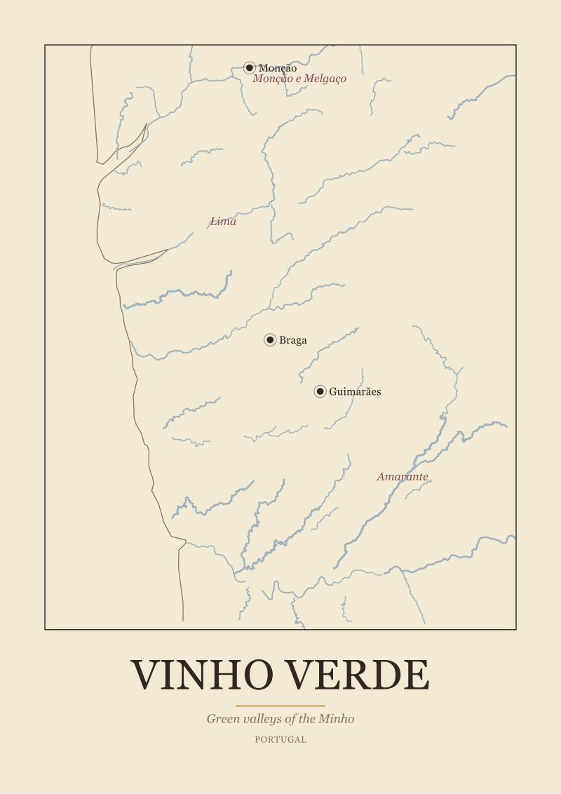
There is also a quieter reason to refuse the ranking. Portugal is one of the last European wine countries where regions still feel like places rather than brands. Vinho Verde is not a marketing category invented to move volume; it is a slice of northwestern Portugal where the Atlantic pushes rain inland and the vines were historically trained high to keep grapes above damp ground. The Douro is not shorthand for Port; it is a valley shaped by human hands into terraces most other countries would never attempt. To rank these against each other is to pretend the map is a scoreboard. The map is not a scoreboard. It is the argument.
Scenario 1: The Reader Who Wants One Region to Understand Portugal
Let us say you have one week, one region, one plane ticket, and a stubborn belief that a country reveals itself best through a single close reading. Picture a reader who is not trying to see everything. They want to walk one landscape until the landscape starts to make sense on its own terms. For that reader, the map keeps pointing to one place: the Douro.
The Douro Valley works as a first region because it collapses several of Portugal's largest geographic ideas into one frame you can walk. The river runs west from the Spanish border and, over roughly 100 kilometres of Portuguese vineyard country, cuts through some of the steepest cultivated slopes in Europe. The bedrock here is schist — the kind of dark, layered stone that fractures vertically and lets vine roots reach deep to find water in a summer that punishes anything shallow-rooted. Above the river, the slopes were shaped by hand into terraces over centuries, first with dry-stone walls, later with wider, machine-navigable terraces called patamares. A single hillside above Pinhão can carry both, and the visual grammar tells you the whole history of labour in one glance.
For our reader, the Douro is the region that answers the question "what is Portugal actually like as a landscape?" more efficiently than any other single stretch of the country. It has the river, the schist, the terraces, the anchor towns that grew because of the wine trade, the working port lodges downstream in Vila Nova de Gaia, and a train line that follows the water from Porto inland. You can take the geography lesson without owning a car, which is not incidental — it means the region can be read on foot and by rail, which is how landscapes teach.
What this scenario does not answer is what the wine tastes like, and we are not going to pretend otherwise. Our reader will find that out on their own, in the towns and cellars and long lunches that this valley has always used to explain itself. Our job is only to say that if you pick one region to understand Portugal through, the Douro gives you the most map for the week. The trade-off is honest: choosing the Douro means not choosing the warm south, and the south is a different Portugal that deserves its own reading.
 Douro
The print from this article · from €29.95
View the print →
Douro
The print from this article · from €29.95
View the print →
Scenario 2: The Reader Who Wants the Warm South, Not the Steep North
Imagine now a reader who has already been north, or who simply does not want vertigo with their vineyards. They want low horizons, oak trees, and a landscape that behaves like a plain rather than a wall. For that reader, the map opens toward the Alentejo.
This is the region our grounding names directly, and the description is exact: warm plains east of Évora, anchored on the Guadiana, with Reguengos and Borba among its towns, and sub-zones that include Borba, Redondo and Reguengos. The Alentejo covers roughly a third of continental Portugal, though its vineyard land is a much smaller subset of that. Geographically, it is what happens when Iberia stops being coastal and becomes interior. Summers are long and hot, the light is direct for most of the day, and the terrain rolls rather than climbs. The Guadiana runs down the eastern edge as a border with Spain and gives the region its slowest, widest river.
The reader who fits the Alentejo is someone who wants scale in a different direction than the Douro offers. Instead of vertical drama, the Alentejo offers horizontal drama: distances that make you conscious of the sky, villages that appear one at a time on the horizon, and a rhythm of cork oaks and vineyards that has been repeating itself for a very long time. Évora is the town most readers use as an anchor — a walled hilltop city that sits between the coast and the border, roughly 130 kilometres east of Lisbon by road. From Évora, Reguengos sits further east toward the Guadiana, and Borba sits north toward the marble country around Estremoz.
For our second reader, the geographic argument is that the Alentejo is the counterweight to the Douro. It is what Portugal looks like when the country stops being a river valley and starts being a plain. If your instinct is to trade altitude for space, and to trade schist for warmer, sandier ground, the Alentejo is the region that rewards the trade. It also happens to be the region most easily paired with time in Lisbon, because the drive east from the capital lands you in the sub-zones before the afternoon is over. That accessibility matters for a reader whose week is not infinite.
Scenario 3: The Reader Planning a Week, Not a Lifetime
Now picture a reader who wants Portugal in the round, not in depth. Seven days, one country, and a willingness to spend some of them on the road. This reader is not choosing between the north and the south — they are trying to fit both into a single map. The question stops being "which region?" and becomes "how do these regions connect?"
The geographic honest answer is that they connect through Lisbon and through the coast. Portugal's shape rewards a north-to-south itinerary because the coastline is the country's spine and every major region has some relationship to it. Our third reader will not read any single region as deeply as the first two, and that is the trade-off they are making. What they get in exchange is scale: a sense that Portuguese wine geography is not one story but three or four overlapping ones, and that the differences between them are large enough to feel from the driver's seat.
A week planned this way tends to look like a triangle. Start in Porto, because it is the closest city to the Douro and the Vinho Verde country, and because Porto itself is a wine-geography lesson before you have left the city — the port lodges in Gaia sit downstream of the vineyards they served, which explains itself the moment you look at the river. From there, spend two or three days moving up the Douro. Then come south to Lisbon along the coast rather than the interior, so that the Atlantic is visible for a stretch of the drive. From Lisbon, cross east into the Alentejo for the last two or three days, aiming for Évora and, if there is time, one of the sub-zones our grounding names — Borba, Redondo, or Reguengos.
What this reader loses is depth. They will not walk any single valley long enough to feel it change with the light. What they gain is the shape of the country, which is the thing a first visit is best spent learning. The map here is doing most of the work. If the week is planned around rivers rather than around towns, the itinerary writes itself.
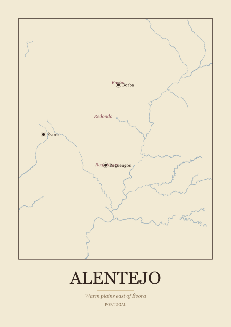 Alentejo
The print from this article · from €29.95
View the print →
Alentejo
The print from this article · from €29.95
View the print →
What All Three Readers Share
Read across all three scenarios and the same pattern surfaces. Every serious answer to "the best wine regions in Portugal" is really an answer to a different question — how much time, how much depth, how much movement. The map does not change; only the reader's route through it does.
There is also a shared refusal running through all three. None of these scenarios is decided by tasting notes. The first reader picks the Douro because the schist and the terraces are legible in a way that rewards a slow week. The second reader picks the Alentejo because the plain and the Guadiana offer a different scale entirely. The third reader picks the triangle because a week is not long enough for depth and it may as well buy shape. In each case the decision is made by geography, not by the glass. The glass is where the decision is confirmed, but it is not where it is made.
The third thing all three share is a healthy resistance to the national ranking. If we had to rank, we would be ranking questions rather than regions. The Douro would be first for the reader who wants one landscape to teach the country. The Alentejo would be first for the reader who wants warmth and space. The triangle would be first for the reader who wants shape over depth. That is three different first places, which is another way of saying the ranking was always incoherent.
Which Scenario Is You
If you are still reading, the useful question now is which of those three readers you actually are. A quick test. If you would rather spend six days on one hillside than six hours each in six places, you are the first reader, and the Douro is the region the map is pointing at. If your instinct when you look at a photograph of the Alentejo is relief rather than restlessness, you are the second reader, and the plain is where your week belongs. If you cannot yet answer either of the first two because you have not been to Portugal at all and want to see the country before you commit to a region, you are the third reader, and the triangle is a fair opening move.
There is no wrong answer here — only a wrongly matched one. The regions do not compete for you. They wait for the version of you that is asking the question they are shaped to answer. If you want to keep the map close while you decide, we draw these regions for a living at our shop, and a wall-sized reading of a river tends to clarify the choice faster than any list ever will.
FAQ
Is the Douro the same thing as Port wine country?
The Douro Valley is where the grapes for Port are grown, so in that sense yes — but the region is much larger than Port alone. The valley also produces still wines, and the geographic story of the Douro (river, schist bedrock, hand-cut terraces) predates the modern division between fortified and unfortified wine. Treating the Douro as a landscape rather than a product category is the more useful lens.
Where exactly is the Alentejo, and how do I reach it from Lisbon?
The Alentejo occupies a large stretch of southern-interior Portugal, east of Lisbon and running down toward the Algarve. The anchor town most visitors use is Évora, roughly 130 kilometres east of Lisbon by road. From Évora, the sub-zones our grounding names — Borba, Redondo and Reguengos — sit further east toward the Guadiana river, which forms the region's eastern edge with Spain.
Can I visit the Douro without a car?
Yes, and this is one of the region's quiet strengths. A train line follows the river from Porto inland, and river cruises operate along the same corridor. The anchor towns along the valley are compact enough to explore on foot once you arrive. A reader who wants a walkable, rail-legible wine region will find the Douro unusually accommodating on that front.
What is Vinho Verde, and where does it fit on the map?
Vinho Verde is the northwestern corner of Portugal, between the Douro Valley and the Atlantic coast up toward the Spanish border in Galicia. Geographically it is defined by rain: the Atlantic pushes moisture inland and the landscape stays greener than most of Iberia. "Verde" refers to the green land, not the colour of the wine. Historically, the vines were trained high to keep fruit above damp ground.
Which region is best if I only have three days?
Three days is a depth question rather than a shape question. Pick either the Douro or the Alentejo, and pick based on whether you want vertical landscape or horizontal landscape. Trying to split three days across both means most of the middle day will be spent moving, and the two ends of the trip will feel rushed. One region, read closely, is the better trade at that budget.
Is the Alentejo hotter than the Douro in summer?
Broadly, yes. The Alentejo is an interior plain with long, direct summer sun and less relief from altitude than the Douro's valley walls. The Douro is also warm in summer, but its terraces and river create more shaded microclimates, and elevation changes offer some relief. For a reader who is heat-sensitive, the shoulder seasons — spring and early autumn — reward both regions and punish neither.
Are there other Portuguese wine regions worth knowing beyond these?
Yes — Dão, Bairrada, Lisboa, Tejo, Setúbal, Madeira and the Azores each carry their own geographic story. We have concentrated on the two regions the map most efficiently teaches to a first-time reader, plus a triangle itinerary that reaches both. A longer stay in Portugal will pull you toward the others, and each one deserves its own close reading rather than a paragraph inside a national ranking.
Why does this article refuse to name a single "best" region?
Because the geography refuses to. Portugal's regions are shaped by different rivers, different bedrocks, different distances from the Atlantic, and different histories of human labour. A ranking would collapse all of that into a scoreboard, and the scoreboard would tell you less than the map. Our job as a studio that draws these regions is to keep the map legible, which means resisting the ranking even when the question invites one.


New regions and 10% off your first print.
One email now with your code. No noise after.