There is a pattern we keep seeing when we draw Europe's great wine regions. The famous names sit on rivers. Bordeaux hugs the Garonne. Burgundy leans on the Saône. Champagne runs along the Marne. Alentejo stretches east from the Guadiana, past Évora and out toward the Spanish border. Four regions, four rivers, one geographic argument that predates every tasting note ever written about them. The wine did not choose the river; the river chose the wine. This is a piece about that choice — what moving water does to a slope, a border, a town — and why the map, more often than the label, explains why a region became famous at all.
The Pattern: Great Wine Sits Downstream of a Slope
The first thing we notice at the drawing table is that the famous vineyards are never on the river itself. They sit above it, on the shoulder of a hill that the river has, over millions of years, cut into shape. A river is a slow blade. Given long enough, it takes the soft rock away and leaves the harder rock as a slope. That slope is where the vines go.
Burgundy is the cleanest example of this on the Continent. The Saône flows south past Dijon and Beaune, and to its west a limestone ridge — the Côte d'Or, literally the golden slope — rises out of the plain. The famous villages of the Côte de Nuits and Côte de Beaune are strung along this ridge like beads on a wire, because the ridge is where the drainage works and the sun hits at the useful angle. The Saône itself is not planted; the vines look down on it. The river's job was to expose the slope in the first place, and then to keep it drained.
Bordeaux tells the same story with different rock. The Garonne, joined by the Dordogne, cuts through gravel and clay left behind by older river beds. What remains above the current channel is a set of low mounds — nothing dramatic, some of them only a few metres high — that drain fast and warm early. The Médoc sits on those mounds on the left bank; Saint-Émilion and its neighbours sit on their equivalents to the east. Nobody plants in the valley bottom. The valley bottom is where the frost sits.
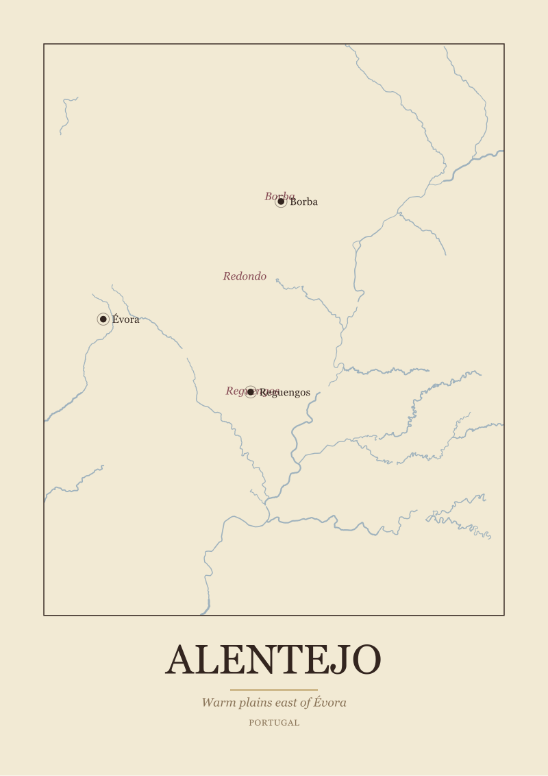
Alentejo works at a wider scale and with more sun. The Guadiana runs south through the Portuguese interior, and the great warm plain around Évora, Reguengos, and Borba is what the river has left behind after cutting through much softer country. Here the slope is gentler, the ridge less theatrical, but the principle is the same: the wine sits where the drainage is honest and the frost is not. Champagne, further north, follows the Marne through chalk country west of Reims, and again the vineyards climb the hillsides above the river — the Vallée de la Marne, the Montagne de Reims — never the flats.
The Pattern: The River Sets the Border Before the Grape Does
Appellations are usually described in the language of grapes and soils, but if you look at where the lines are actually drawn, most of them are drawn against water. The river came first. The border traces the river. The grape is a consequence of both.
Bordeaux is the clearest case. The Garonne and the Dordogne meet north of the city to form the Gironde estuary, and this three-way system — Garonne, Dordogne, Gironde — is the region's spine. Everything on the western shore of the estuary and the Garonne is the Médoc and Graves and Sauternes; everything on the eastern shore is Saint-Émilion and its satellites. The Left Bank and Right Bank divide is not a slogan invented by wine writers. It is a description of what happens when a river cuts a region in half and each side develops its own soil, its own grape emphasis, its own commercial history. You cannot understand Bordeaux by walking the vineyards. You have to see the water.
Champagne's border is also a water border, though it is drawn differently. The Marne slices west-to-east across the region and organises it into subzones that read almost like a compass rose: Vallée de la Marne along the river itself, Montagne de Reims to the north, Côte des Blancs to the south. Épernay and Aÿ sit on the water; Reims sits on the chalk hills above. The appellation follows the chalk, and the chalk follows the river's own history of exposing it.
Alentejo behaves the same way at a wider scale. The subzones — Borba, Redondo, Reguengos — array themselves across the country the Guadiana has shaped, and the appellation border eventually runs into the Spanish frontier, itself defined for a long stretch by the same river. The wine border and the political border are two readings of one line of water. Burgundy is the outlier in the group; here the appellation follows the ridge rather than the Saône directly, but the ridge exists because the Saône exists, so the logic is the same, one geological step removed.
A wine region is what a river leaves behind after it has finished deciding where the towns will go.
 Bordeaux
The print from this article · from €29.95
View the print →
Bordeaux
The print from this article · from €29.95
View the print →
The Pattern: Anchor Towns Are Older Than the Appellation
Every one of these regions has a town — usually more than one — that was famous long before its wine was. The town came first because the river made it inevitable. Trade needs a crossing, a bend, a confluence, a defensible bank. The Romans and their successors built where the water told them to build. The wine trade then attached itself to the town, because the town already had the roads, the merchants, the ledger books, and the wharves.
Bordeaux is a port before it is anything else. The city sits on the Garonne where the river is still tidal and still navigable for serious ships, and this is why Bordeaux wine — of every quality level, from the great châteaux of Pauillac to the everyday reds of the Entre-Deux-Mers — was historically shipped in Bordeaux barrels down to London and Bruges and Amsterdam. The name on the bottle is the name of the exit door. Saint-Émilion and Pauillac exist as wine addresses because Bordeaux existed first as a shipping address.
Burgundy repeats the pattern with an inland twist. Dijon is a ducal capital before it is a wine capital; Beaune is a market town on the road that runs alongside the Saône corridor. Nuits-Saint-Georges is named for what it is: a village on the ridge that took the name of the saint and, eventually, the name of the wine. The Saône was — and in parts still is — a working river connecting the north of France to the Rhône system and, via that, to the Mediterranean. Burgundy became famous partly because its wine could actually leave.
Champagne has Reims and Épernay, and both are as old as the Roman roads that connect Paris to the eastern frontier. Aÿ, tucked into the Marne valley, is older as a wine name than most people realise. Alentejo, further from the great trade currents, still has Évora — a walled town of Roman and medieval fame that anchored the plain long before anybody attached the word "denominação" to the Guadiana country around it. In every case the sequence is the same: river, then town, then trade, then, only at the end, appellation. When we draw these regions we draw the towns first because the vines followed them.
The Pattern: The Climate Line Runs Along the Water
The last thing rivers do, and the least obvious, is manage temperature. A river valley is a climate feature in its own right. It carries cool air at night, holds fog in the morning, stores heat in the water through late autumn, and cuts a corridor that maritime weather can travel inland along. The exact character of a wine region often depends less on latitude than on whether the river is doing this work or not.
Champagne is the extreme case. It sits at roughly the northern edge of what Europe can ripen for still wine, and the reason it grows anything at all is that the Marne valley funnels slightly warmer air westward from the continental interior, while the chalk substrate stores daytime heat and releases it slowly. Without the river corridor, the Montagne de Reims would be too cold too often. The style of the wine — high acid, low potential alcohol, useful for a second fermentation in bottle — is the direct signature of a region that barely ripens grapes. Champagne is champagne because the water bought it fifteen extra days of autumn.
Bordeaux is the opposite problem: too warm to be delicate on its own, cooled and modulated by the Atlantic that reaches inland via the Gironde estuary. The estuary is what makes Bordeaux temperate rather than simply warm. When a hot summer arrives and the rest of southwestern France bakes, the estuary and the two rivers keep the vineyards on both banks within a workable range. Take the water away and Bordeaux becomes something more like the southern Rhône.
Burgundy uses the Saône as a heat store and a fog manager. The great slope faces east and gets the morning sun burning off the valley mist, which is a river-made feature. Alentejo uses the Guadiana less for cooling and more for water, in a country that needs it; the plain gets its Atlantic influence weakened by distance, and the river is one of the few things that keeps the deep summer manageable at all. Four rivers, four climate arguments, and in each case the wine style is legible directly from what the water is doing. The river is not a decoration on the label. It is the reason the label exists.
 Champagne
The print from this article · from €29.95
View the print →
Champagne
The print from this article · from €29.95
View the print →
So What Do You Actually Do
If you want to read a wine region — any wine region, not just the four we have drawn here — start with the water. Find the river on a map before you find the vineyard. Ask which side of it the vines sit on, and how high above it, and which way the slope faces. Ask where the town is that gave the region its shipping name. Then look at the appellation border and see whether it traces the river, hugs a ridge the river cut, or stops at a confluence. Nine times out of ten, the border makes sense only after the river is in view. This is why our prints put the water in first and the vineyard names in second: the water is the thing that was there when the decisions were made.
For the four regions here — Alentejo along the Guadiana, Bordeaux between the Garonne and the Dordogne, Burgundy above the Saône, Champagne along the Marne — the practical takeaway is the same. Do not read them as flavour categories. Read them as geographies with a wine industry attached. When you understand the estuary, you understand the Left Bank and the Right Bank without anyone having to explain it. When you understand the ridge above the Saône, you understand why the Côte d'Or is a line and not a blob. When you understand how far north the Marne runs, you understand why the local wine has bubbles.
A last honest limit. This piece does not deal with the specific geology of each slope in detail — chalk, limestone, gravel, schist all deserve their own arguments and their own maps, and we will draw them one at a time. It does not deal with rivers outside these four; the Douro, the Rhône, the Mosel, the Ebro each reshape the argument in useful ways and each earn their own reading. And it does not name producers, because our desk is a map desk, not a merchant's desk. What we have offered here is the frame: rivers first, regions second, everything else after. If the frame is useful, our shop at see the Bordeaux print has the maps that hold it up on the wall.


New regions and 10% off your first print.
One email now with your code. No noise after.