Four regions. Four rivers. Bordeaux sits between the Garonne and the Dordogne. Burgundy leans on the Saône. Champagne is drawn along the Marne. Alentejo stretches east across the Guadiana plains. Pull those four facts out of the Natural Earth 1:10m rivers layer and lay them side by side, and you have already answered most of the question people ask when they ask how wine regions got their borders. The border is usually the river, or the slope the river cut, or the town the river fed. The rest is paperwork catching up with geography.
What the Grounding Actually Says
Start with the plainest reading of the map. On our working file — the Natural Earth 1:10m rivers-and-coastline layer, the public-domain base every serious cartographer keeps within reach — Bordeaux resolves as a wedge of land held between two water courses. The Garonne runs up from the south. The Dordogne comes in from the northeast. They meet, become the Gironde, and empty into the Atlantic. Every sub-zone Bordeaux is famous for arranges itself around that hydrology: Médoc on the left bank of the estuary, Saint-Émilion on the right of the Dordogne, Graves and Sauternes trailing the Garonne south of the city. Ask where Bordeaux "is" and the river system draws the answer for you.
Burgundy is a different sentence written in the same grammar. Our grounding names the Saône as the main river and the character as "the golden slope of the Côte d'Or." Dijon anchors the north; Beaune sits mid-slope; Nuits-Saint-Georges holds the junction between the Côte de Nuits and the Côte de Beaune. The vineyard land is not on the river itself but on the escarpment that runs parallel to it — the slope the Saône valley carved into the Massif du Morvan's eastern edge. The river gave the region its market road, the wine barges, the merchants at Beaune. The slope gave it the wine.
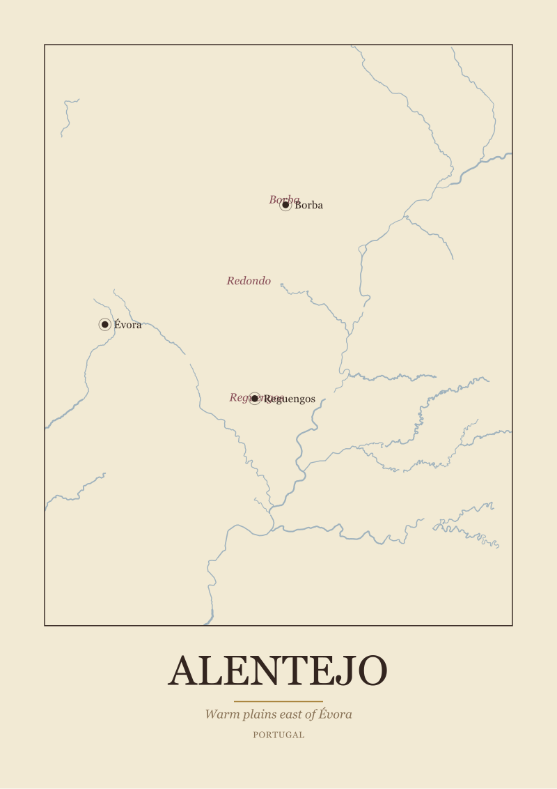
Champagne, according to the same layer, is a chalk landscape cut by the Marne. Reims sits on high ground north of the river; Épernay sits on the Marne itself; Aÿ is a village name that appears in wine documents from before most modern borders existed. The three sub-zones — Montagne de Reims, Vallée de la Marne, Côte des Blancs — are three geographic answers to a single question about where grapes ripen at all in a place this far north. And Alentejo, the outlier of the four, is not a river-slope region but a plain: warm country east of Évora, with Reguengos and Borba as anchor towns and the Guadiana running east through the interior. Its sub-zones — Borba, Redondo, Reguengos — are the parishes the wine industry organised itself around.
Four regions. Four different geographic logics — estuary wedge, escarpment, chalk shelf, warm plain. And four historically distinct answers to what a "border" means when you draw one around a wine.
What Nobody Mentions About a Border
Here is the part that most explainer articles skip. A wine region's border is at least three different objects stacked on top of each other, and they were not drawn at the same time or by the same people.
The first border is the geographic one — the river the region actually sits on, the slope it climbs, the ridgeline that separates its water from the next valley's. This border predates any wine law. The Garonne cut the gravels of the Médoc long before anyone in Pauillac ever sold a barrel. The Côte d'Or's escarpment was there when the Romans arrived and would be there if every vineyard on it were abandoned tomorrow. The chalk under Champagne is the reason Champagne is Champagne; the appellation did not invent the chalk. When we draw these regions at the studio, this is the border we start with, because it is the only one that is not going to change in a lifetime.
The second border is the town border — the market network. Bordeaux the region is unthinkable without Bordeaux the port. Beaune organised the Burgundian wine trade for centuries. Reims and Épernay together decide what Champagne means in commerce, and Aÿ carries the historical weight of a village that mattered when villages were the units of reputation. Évora sits at the centre of Alentejo the way a hub sits inside a wheel; Reguengos and Borba are the working towns of the trade. These borders were drawn by carts and rivers and the distance a barrel could travel before spoiling. They are older than any bureaucratic line and, in most cases, they still describe the true economic shape of the region better than the modern map does.
The third border is the appellation — the legal line, the one printed on the label. This is the youngest of the three. The French appellation system as we know it was consolidated in the 20th century; the Portuguese denomination framework followed a similar arc. These lines were drawn to codify what was already true: the town network was recognised, the geographic features were surveyed, and the resulting polygon was declared official. The appellation is paperwork catching up with geography, and, occasionally, paperwork disagreeing with it. When a slope on the wrong side of a legal line grows grapes indistinguishable from the slope on the correct side, that disagreement becomes the wine world's version of a border dispute — small, technical, and consequential enough that people spend careers arguing it.
The trap most writing on this topic falls into is treating the appellation as if it invented the region. It did not. The Côte d'Or existed before the Côte d'Or was capitalised. What the appellation did was freeze one particular reading of a much older map.
 Champagne
The print from this article · from €29.95
View the print →
Champagne
The print from this article · from €29.95
View the print →
The Real Shape of a Region
If you strip away the labels and the certifications and look only at what the Natural Earth data actually shows you, the shape of each region tells a different geographic story about why it became famous in the first place.
Bordeaux's shape is dictated by the estuary. The Gironde is an unusually wide, unusually navigable body of water, and the vineyard land arranges itself around access to it. Médoc is a peninsula between the estuary and the Atlantic. Saint-Émilion sits on the right bank of the Dordogne, upstream of the confluence — a limestone plateau above a working river. Graves runs along the Garonne south of the city itself. Sauternes is a pocket where a cold tributary, the Ciron, meets the warmer Garonne and generates the autumn mist that made the region famous. The border of Bordeaux is not a line at all. It is a hydrological network with vineyards facing whichever way the water tells them to face.
Burgundy's shape is a strip. The Côte de Nuits and the Côte de Beaune together form a narrow band of escarpment running roughly north-south for a distance you can drive in an unhurried afternoon. The reason the region is not wider is that the geology is not wider; the good slope stops where the slope itself stops. Dijon anchors the north end, Beaune sits at the transition, Nuits-Saint-Georges names the junction, and every village between them has argued its case for centuries about exactly which patch of the strip belongs to which reputation. Burgundy is the wine region that most rewards a topographic map: the closer you look, the more the border resolves into contour lines.
Champagne's shape is a chalk shelf broken into three arms. The Montagne de Reims curves south of the city. The Vallée de la Marne follows the river west. The Côte des Blancs runs south from Épernay. Draw them together and you get a rough Y-shape sitting on top of a chalk plateau, and the reason the plateau matters is that chalk drains, holds warmth, and reflects light in a place where grapes are always closer to failing to ripen than to over-ripening. Champagne grows where grapes barely ripen, and the border is essentially the outline of where the chalk stops.
Alentejo is the exception that clarifies the rule. There is no single defining slope; the region is a warm interior plain. Its "shape" is a network of towns — Évora at the centre, Borba, Redondo and Reguengos organising the sub-zones — and a river, the Guadiana, running through the eastern part of the landscape. The border of Alentejo is drawn by climate more than by relief: it is the country where the Atlantic influence has faded and the interior heat takes over, and the towns are where the wine culture organised itself to work with that heat. When we draw Alentejo at the studio, we lean on the town network and the river rather than the topography, because that is the geographic reality.
Four regions. Four fundamentally different geographic answers to the same question. And in every case the appellation border, when you overlay it, is best understood as a formal recognition of what the land was already doing.
If You Only Remember One Thing
Wine region borders are not lines someone drew on a blank map. They are the outline of a river system, a slope, a chalk shelf or a warm interior — and then a network of towns that organised the trade — and only then a piece of paperwork that legally recognised both. Read in that order, the borders make sense. Read from the paperwork backwards, they never quite do.
If you want to look at any famous European wine region and understand why its shape is what it is, start with the river layer and the topography. The wine reputation followed. If you would like a considered geographic drawing of any of these regions — Bordeaux, Burgundy, Champagne or Alentejo — done from the same public-domain base we have been reading here, you can find our studio prints at see the Champagne print.
This piece did not address the legal history of appellation law itself — the specific 20th-century decrees and how they were negotiated — because that is a legal argument, not a geographic one, and we are a geography desk. It did not address grape varieties, which are a botanical and cultural question layered on top of the geography rather than the geography itself. And it did not attempt to map every wine region in Europe; four regions is enough to draw the pattern honestly. Each of those is a different article, and we will get to them in turn.
 Bordeaux
The print from this article · from €29.95
View the print →
Bordeaux
The print from this article · from €29.95
View the print →
FAQ
Why is the river so central to how a wine region's border is drawn?
Rivers do three things at once. They physically shape the landscape — cutting slopes, depositing gravels, carving valleys where grapes ripen well. They provide the transport network that made a wine commercially viable before railways existed. And they anchor the towns that organised the trade. When the geographic border, the commercial border and the town network line up along the same river, the region becomes historically legible. Bordeaux and Burgundy are the clearest examples of this stack.
Did the appellation systems invent wine regions or just formalise them?
Almost always the latter. The famous European regions existed as recognised geographic and commercial units for centuries before any modern legal framework was written. The 20th-century appellation systems in France and their Portuguese equivalents codified boundaries that were already broadly agreed by growers, merchants and consumers. The paperwork mattered — it gave the borders legal force and protected the names — but it did not draw the regions from scratch. In most cases the appellation is a formalisation of an older map.
Why does Burgundy look like such a narrow strip on the map?
Because the geology is a strip. The Côte d'Or is an escarpment — a slope carved by the Saône valley cutting into higher ground to the west. The vineyard land is essentially the width of that slope, running north-south from Dijon down past Beaune and Nuits-Saint-Georges. The region cannot be wider than the escarpment itself, and everything east and west of the strip is a different landscape entirely. Burgundy is the wine region where topography sets the boundary most obviously.
What makes Champagne's border different from Bordeaux's or Burgundy's?
Champagne is defined by chalk, not by a slope or an estuary. The Marne cuts through a chalk plateau, and the sub-zones — Montagne de Reims, Vallée de la Marne, Côte des Blancs — are three arms of that plateau where grapes can just about ripen in a cool northern climate. The border is essentially the outline of where the chalk sits close to the surface and the aspect is right. It is a geological border more than a topographic one.
Why is Alentejo organised around towns rather than a slope?
Because it is a plain, not a valley. Alentejo is the warm interior of southern Portugal, east of Évora, and the character of the region comes from climate — Atlantic influence fading, interior heat rising — rather than from a defining relief feature. In a landscape like that, the towns become the organising units. Évora anchors the centre; Borba, Redondo and Reguengos each name a working sub-zone. The Guadiana runs through the eastern interior. The border is drawn by climate and settlement, not by a ridgeline.
Do wine region borders ever change?
Rarely, and usually at the margins. The geographic base — the river, the slope, the chalk — does not change in any human timescale. The town network shifts slowly with commerce. What does occasionally change is the legal boundary at the edges, when a particular vineyard argues for inclusion or a sub-zone is subdivided. These arguments are technical and often heated, but they do not redraw a region wholesale. The core outline of Bordeaux, Burgundy, Champagne or Alentejo today would be recognisable to a merchant from a century ago.
What is the best single map layer to understand European wine regions?
For our work at the studio we start with the Natural Earth 1:10m rivers and coastline layer — a public-domain base that is honest about the water and the coasts without over-drawing them. Add a topographic layer for regions like Burgundy where slope matters, and a geological layer for regions like Champagne where the substrate matters. The appellation boundary goes on last, as the label rather than the foundation. Read in that order, the borders explain themselves.


New regions and 10% off your first print.
One email now with your code. No noise after.