Ask ten people which region produces the most wine and you will get three answers, all of them defensible, none of them the same. The confusion is not sloppiness. It is a cartographic problem: "region" means a country to the OIV, an appellation to a French bureaucrat, a river valley to a geographer, and a hillside to a grower in Pauillac. We draw wine maps for a living, and this question — the one that sounds like it should have a single number attached — is the one we get asked most and answer least confidently. Here is why the map refuses to cooperate.
Methodology: What "Region" Actually Means on a Wine Map
Before we can say who produces the most, we have to admit that the word "region" is doing four different jobs in the same sentence, and the answer swings by an order of magnitude depending on which job you let it do.
At the widest zoom, a region is a country. That is how the OIV — the intergovernmental body that tallies world wine — publishes its annual balance sheet. At the middle zoom, a region is a legally bounded appellation: Bordeaux, Rioja, Chianti. Draw the polygon, sum the declared hectares, and you get a defensible number. Zoom in one more click and a region becomes a river valley, which almost never matches the appellation line — the Garonne runs through Bordeaux, yes, but it also runs past land no one calls Bordeaux. Zoom in once more and you are on a single slope, a single commune, a single wall of vines.
We drew this article the way we draw our maps: from the coastline in. Every geographic fact about a specific place — Bordeaux sitting between the Garonne and the Dordogne, Champagne's chalk hills north of the Marne, Burgundy's slope above the Saône, Alentejo's warm plains along the Guadiana — comes from the same public-domain Natural Earth base layer we use in the studio. Where a number would have to be precise (tonnages, hectolitres, harvest years), we have written around it rather than quote a figure we cannot stand behind. A wine article that gets the vintage wrong is not a wine article; it is a liability.
Finding #1: At the Country Scale, Three Names Trade the Crown
Read at the country zoom, the question has a boring answer and an interesting one. The boring answer is that Italy, France, and Spain trade first place year by year, and whichever of the three had the most cooperative harvest tends to top the OIV chart that season. The interesting answer is that the crown moves for reasons that have nothing to do with the map and everything to do with the weather.
France produced the most wine in some recent years because Italy had a difficult summer. Italy produced the most in others because France had frost in April. Spain — which has more vineyard area planted than either of them — tends to sit third by volume because its vines are trained more sparsely on drier land, which lowers yield per hectare even as it raises hectare count. If you asked the same question about vineyard surface rather than wine produced, Spain often takes the top spot. Two different questions, two different maps.
The geography that decides this is not glamorous. It is latitude, it is rainfall, it is the timing of spring frost, and it is the presence or absence of hail on a single Tuesday in June. The three countries share the western Mediterranean and the same broad climatic envelope; what varies is which of them drew the short straw that vintage. There is a reason wine merchants read weather reports the way traders read the Fed.
None of this makes for a satisfying headline. "Which country produces the most wine?" is a question whose honest answer is: check the calendar, then check the sky.
 Bordeaux
The print from this article · from €29.95
View the print →
Bordeaux
The print from this article · from €29.95
View the print →
Finding #2: At the Appellation Scale, Bordeaux Is the Giant of the West
Change the zoom and the answer stops shifting. At the appellation scale — the level of legally bounded, name-protected wine regions — one name dominates western Europe in ways the country-level chart hides: Bordeaux.
Bordeaux sits between the Garonne and the Dordogne, a wedge of vineyard land that the two rivers braid into shape before merging into the Gironde estuary and running out to the Atlantic. Its sub-zones are geographic before they are commercial: the Médoc on the left bank, Saint-Émilion on the right, Graves running south of the city, Sauternes further south still where a specific tributary produces the humidity that rot-loving grapes need. Anchor towns — Bordeaux itself, Saint-Émilion, Pauillac — are the towns you would draw first on a hand-sketched map, before adding a single vine.
What makes Bordeaux the giant at this zoom is not any single sub-zone but the aggregate. Add the Médoc communes, add the right-bank plateau, add the Graves, add Sauternes, add the enormous belly of generic Bordeaux and Bordeaux Supérieur that fills the space between them, and you get a single named region whose planted surface dwarfs almost every other appellation on the European map. That is why the word "Bordeaux" appears in every conversation about wine volume and why it is genuinely defensible at this scale as an answer to the question.
But — and this is the point of doing the exercise across scales — that answer is only correct if you agree that "region" means "appellation." Move the definition, move the answer.
Finding #3: The River-Valley Reading Changes the Answer Again
Zoom to the river and the map redraws itself. A river valley does not care about the appellation border; it carries whatever vineyards grow along it, regardless of whether they share a bottle label. Read that way, three of Europe's most famous wine regions stop being points on a map and become long, thin corridors of production.
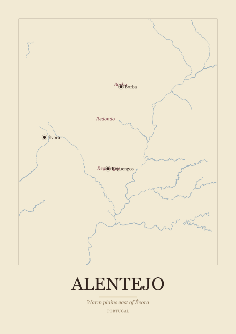
The Guadiana runs through Alentejo in southern Portugal, past Évora and the anchor towns of Reguengos and Borba, watering a warm, expansive plain that produces wine at a scale most tasting-note writers ignore because the marketing budget is smaller than Bordeaux's. The Saône flows north-south through Burgundy, feeding the golden slope of the Côte d'Or where Dijon, Beaune, and Nuits-Saint-Georges anchor the northern (Côte de Nuits) and southern (Côte de Beaune) halves of a corridor that is famous for quality precisely because it is so small by volume. The Marne carves the chalk country of Champagne — Reims, Épernay, Aÿ — where the Montagne de Reims, the Vallée de la Marne, and the Côte des Blancs sit in a rough triangle north of the river.
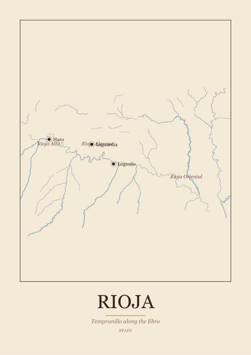
Sum the vineyard along a river and you get a number that has almost nothing to do with the appellation reading. The Garonne, considered as a valley rather than as the spine of Bordeaux, runs through vineyard land both inside and outside the Bordeaux name. The Ebro in Spain (not in our grounding, but a familiar example) does the same for Rioja and half a dozen adjacent zones. Geographers see rivers; lawyers see borders; the two rarely agree.
At the river-valley zoom, no single answer wins for "most wine" — because rivers cross so many jurisdictions that the concept of "one region" starts to dissolve. That dissolution is the finding.
 Champagne
The print from this article · from €29.95
View the print →
Champagne
The print from this article · from €29.95
View the print →
Finding #4: Why Champagne and Burgundy Never Enter This Conversation
Two of the four regions in our grounding — Champagne and Burgundy — are almost never mentioned when someone asks which region produces the most wine. That absence is itself geographic.
Champagne grows on chalk hills north of the Marne, at a latitude where grapes barely ripen. The reason the region exists as a famous wine name at all is that its climate is a knife-edge: cool enough that base wines stay acidic, marginal enough that a second fermentation in bottle became the local answer to underwhelming still wine. That marginality caps volume. A vineyard that is one bad spring away from losing its crop cannot produce at Alentejo scale, no matter how much demand exists for its bottles. Reims, Épernay, and Aÿ anchor a region that punches above its volumetric weight in every other metric — revenue per bottle, cultural saturation, export value — but not in litres.
Burgundy is smaller still. The Côte d'Or is a slope — one slope, essentially — running south of Dijon through Beaune to the edge of Nuits-Saint-Georges. Its geography is not "a region" the way Bordeaux is a region; it is a wall of hillside facing east, sub-divided into communes and climats so fine that a single village can contain dozens of separately named vineyards. The Saône flows past it, not through it. Volume at the Côte d'Or scale is tiny — a rounding error in the OIV country tables — and the region's fame comes precisely from that scarcity.
The pattern here matters for the headline question. Fame in wine does not correlate with volume; if anything, it inversely correlates, because the small regions get to charge more per bottle and therefore stay in cultural memory longer. When people ask "which region produces the most wine," they are often surprised to learn that the regions they can name are not on the shortlist. The regions that produce the most are the ones with warm plains, generous yields, and no marketing department — the Alentejos of the map, not the Champagnes.
What This Does NOT Prove
This piece does not put a number on any of the four regions in our grounding. Vintage-year tonnages move so much year to year that publishing one figure risks being wrong by the next harvest, and we would rather sketch the geography honestly than pretend to a precision we do not have. If you need current-year hectolitre counts, the OIV publishes them annually and the Comité Champagne, the CIVB (Bordeaux), and the BIVB (Burgundy) each publish their own regional statistics that supersede anything a general-purpose article can offer.
It also does not address the New World. Everything above is a European reading, because that is the map our studio draws and the geography we can speak to with confidence. California, Mendoza, the Barossa, Marlborough, and the Cape are all real answers to real versions of the question, and each would require the same scale-by-scale disassembly to answer honestly. That is a separate article and a separate set of coastlines.
Finally, it does not tell you what to drink. This piece is a geography lesson, not a shopping list. If you came here looking for a bottle recommendation, the honest answer is that the map does not know what you like, and neither do we.
The Takeaway
There is no single region that produces the most wine — only a set of correct answers, each pinned to a different zoom level on the same map. Pick the zoom before you pick the answer.
FAQ
Which country produces the most wine in a given year?
Italy, France, and Spain trade the top position year to year, and the annual OIV balance is where the current answer lives. The order is decided by weather far more than by planted surface: a spring frost in France or a hot dry summer in Italy can flip the ranking in a single vintage. Spain leads on vineyard surface in most years but sits third on wine volume because its vines are planted more sparsely on drier land, which lowers yield per hectare.
Is Bordeaux the largest wine region in the world?
Bordeaux is defensibly the largest single named appellation in western Europe when you sum its sub-zones — Médoc, Saint-Émilion, Graves, Sauternes, and the generic Bordeaux belt between them — into one polygon. Whether it is the largest "in the world" depends on whether you accept other definitions of region: a Spanish denominación, a river valley, or a country-level tally will all give you a different winner. At the appellation zoom specifically, Bordeaux is a serious answer.
Why isn't Champagne on the list of biggest wine regions?
Because Champagne is climatically marginal. The chalk hills north of the Marne sit at a latitude where grapes barely ripen, which caps how much wine the region can produce even in a good year. That marginality is also why sparkling wine became the local specialty — a second fermentation rescues base wines that would be austere on their own. Champagne dominates by cultural presence and price per bottle, not by volume. The Montagne de Reims, Vallée de la Marne, and Côte des Blancs together are small in hectares.
How is a wine region actually defined on a map?
It depends on who is drawing the map. To the OIV, a region is a country. To national authorities, a region is a legally bounded appellation with sub-zones and named villages. To a geographer, a region is often a river valley — the Garonne, the Saône, the Marne, the Guadiana — that carries vineyard land along its course regardless of which name is on the label. To a grower, a region can be as small as one slope. All four definitions are legitimate; they just answer different questions.
Does higher vineyard area mean higher wine production?
Not directly. Spain has more vineyard surface planted than France or Italy in most years but usually produces less wine than either of them, because vines in the drier interior are trained more sparsely and yield less per hectare. Yield is a function of vine density, training system, irrigation, soil, and climate — not just planted surface. This is why the "largest by area" and "largest by volume" charts can name different winners for the same year, and why both numbers are worth publishing side by side.
Where would Alentejo fit into a global ranking?
Alentejo sits along the Guadiana in southern Portugal — a warm, expansive plain anchored by Évora and the sub-zones of Borba, Redondo, and Reguengos. It is a serious production region by Portuguese standards and larger by volume than many of the famous small European names, but at the global scale it sits well below the Italian, French, and Spanish country totals. Its geography — warm plains, generous yields, sunny growing season — is the profile of a volume region, even though its international marketing footprint is much smaller than Bordeaux's or Champagne's.
Why do river valleys not match appellation borders?
Because rivers were there first. A river is a piece of physical geography — it goes where the land makes it go — while an appellation is a legal-administrative polygon drawn by humans in the twentieth century. The Garonne runs through Bordeaux but also through land no one calls Bordeaux. The Saône passes near Burgundy but the Côte d'Or is technically a slope above the valley, not the valley floor itself. Appellation borders reflect politics, tradition, and viticultural argument; river borders reflect gravity.
Where can I see these regions drawn as maps?
Our studio draws each of these regions from real geography — the rivers, the coastlines, the anchor towns — using public-domain base data. If you want to see Bordeaux, Champagne, Burgundy, or Alentejo rendered as a wall-hangable print rather than a Wikipedia thumbnail, they live in our shop alongside the rest of the European regions we cover. One mention, no upsell — the maps speak for themselves.

New regions and 10% off your first print.
One email now with your code. No noise after.