Pull up the entry for Bordeaux and the main river is the Garonne. Pull up Burgundy and the main river is the Saône. Pull up Champagne and it is the Marne. Pull up Alentejo, down in southern Portugal, and it is the Guadiana. Four of the most reflex-cited wine regions in Europe, and the shared geographic feature is not a mountain range. It is a river. We spent a morning laying the four side by side on a map we were preparing for the shop, and the pattern was almost rude in how obvious it was. The received wisdom had the wrong noun.
The sentence we kept hearing — on wine podcasts, in beginner guides, in that one travel article everyone links to — was some version of "great vineyards sit at the foot of mountains." It is a nice sentence. It has drama. It is also, taken as a general rule for the regions people actually drink from, wrong in a way that is easy to prove with a map and ten minutes.
The Receipt: Four Regions, Four Rivers, Zero Mountains
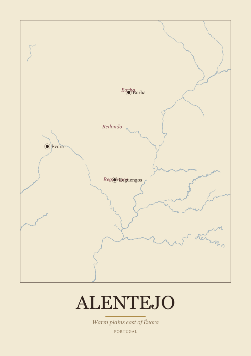
Here is the receipt we were staring at. Bordeaux: main river the Garonne, anchor towns Bordeaux itself, Saint-Émilion and Pauillac, sub-zones Médoc, Saint-Émilion, Graves and Sauternes. Burgundy: main river the Saône, anchor towns Dijon, Beaune and Nuits-Saint-Georges, sub-zones Côte de Nuits and Côte de Beaune. Champagne: main river the Marne, anchor towns Reims, Épernay and Aÿ, sub-zones Montagne de Reims, Vallée de la Marne and Côte des Blancs. Alentejo: main river the Guadiana, anchor towns Évora, Reguengos and Borba, sub-zones Borba, Redondo and Reguengos.
Four regions. Four rivers. Not a single Alp, Pyrenee, or Serra in the list. The Pyrenees are south of Bordeaux by a long drive. The Alps are east of Burgundy by a longer one. Champagne sits in the chalk country north-east of Paris; the nearest proper mountain range is a concept, not a landmark. The Serra de São Mamede nudges the north of Alentejo, but the region's definition — the one the appellation uses, the one the anchor towns describe — follows the plains and the Guadiana east of Évora, not the hills.
The copy on wine-tourism blogs loves the word "foothills." The actual map of the regions that produced the wines those blogs are selling bottles of is a river map. Garonne, Saône, Marne, Guadiana. If a reader memorised only the four river names, they would have a more accurate mental model of European wine geography than most introductions give them. The mountain line is a stock image. The river line is a receipt.
We should be careful here. We are not claiming no vineyard anywhere sits near a mountain. We are claiming that the regions a general reader is most likely to encounter — the regions a wine shop references, the ones the maps on our wall are drawn of — organise themselves around rivers. That is the pattern worth teaching first. The mountain story is the exception people have been taught as the rule.
What the Numbers Actually Say
Read the four entries again, slowly, and the shape of each region snaps into focus. Bordeaux is described in the geography as sitting "between the Garonne and the Dordogne." That preposition — "between" — is doing the whole job. The region is defined by the land caught between two rivers running west to the Atlantic. The Médoc is left-bank of the Garonne-Gironde system; Saint-Émilion is right-bank of the Dordogne; Graves hugs the river upstream from the city; Sauternes sits where a cold tributary slides into a warmer main stem and generates the autumn fog the sweet wines need. The sub-zones are a legend to a river map.
Burgundy is called "the golden slope of the Côte d'Or." A slope. Not a mountain. The Côte d'Or is a long low escarpment running roughly north-south, and the vineyards face east, catching morning light and leaning away from the prevailing weather. The main river, the Saône, runs down the plain to the east. Dijon sits at the northern end of the famous strip; Beaune anchors the middle; Nuits-Saint-Georges sits where the Côte de Nuits hands over to the Côte de Beaune. If a visitor stands in a Grand Cru vineyard in Vosne-Romanée and turns around, the Saône valley is the view, not any kind of peak.
Champagne is described as "chalk hills north of the Marne." Hills, again, not mountains. The Montagne de Reims is a plateau with a dramatic name; it tops out at a modest elevation and its real distinction is the chalk underneath, not the altitude above. The Vallée de la Marne is a river reading in its own name. The Côte des Blancs is another low chalk escarpment south of Épernay. Reims and Épernay are not alpine towns; they are river-and-chalk towns.
Alentejo is "warm plains east of Évora." Plains. The word is in the grounding. The Guadiana runs through the region on its way south to the Atlantic via the Algarve border with Spain. Borba, Redondo and Reguengos are not mountain villages; they are towns on the warm interior of Portugal where the sun is the climate story and the river is the geographic spine. There are hills — most European wine country has hills — but hills and mountains are not the same noun, and the pattern will not survive the swap.
 Bordeaux
The print from this article · from €29.95
View the print →
Bordeaux
The print from this article · from €29.95
View the print →
What Nobody Mentions
Here is the part the beginner guides skip. The rivers in these four regions are not decorations. They are doing specific work, and the work is why the regions became famous in the first place. A river moderates temperature, which protects vines from frost in spring and ripening collapse in autumn. A river carves a valley, which creates slopes, which creates aspect — the direction a vineyard faces — which decides how much sunlight ripens the fruit. A river deposits gravel on one bank and silt on the other, which is why Bordeaux's left bank and right bank produce wines made from different grapes with different textures.
A river also provided the thing that made these places commercial centres before motorways existed: transport. Bordeaux's wine trade exists at the scale it does because the Gironde estuary let Dutch, English and Hanseatic ships load barrels straight off the quay. The Marne carried Champagne toward Paris. The Saône and its downstream partner the Rhône carried Burgundy south. The Guadiana was a working river for the Alentejo interior long before anyone was writing about terroir on an Instagram caption. The regions are famous because they could reach a market. The market reached them by water.
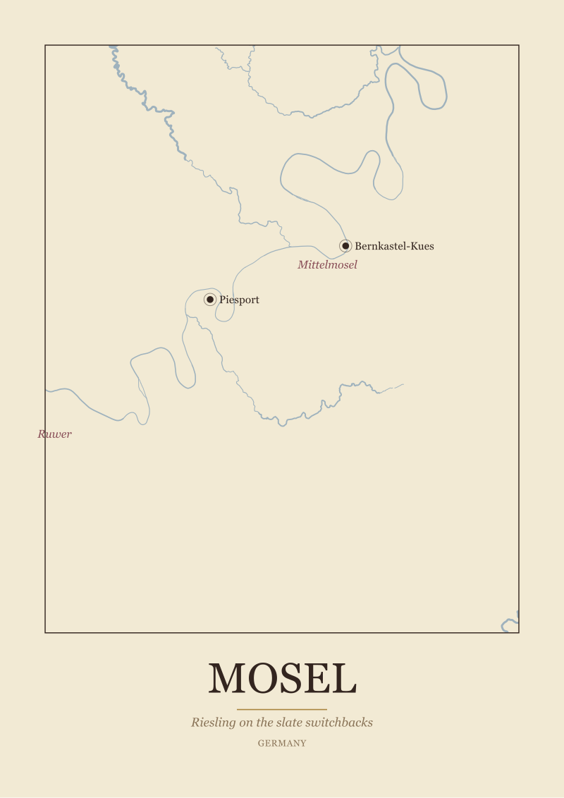
Mountains, by contrast, mostly keep wine from happening. They cast rain shadows, which can be useful on their lee side but ruinous on their windward side. They lift land to altitudes where vines will not ripen reliably. They cut off valleys from each other, which is good for isolation and bad for commerce. The regions where mountains do define the wine — Priorat, the Mosel at its steepest bends, pockets of the Alps — are the exceptions that prove the rule, and they tend to be smaller, more extreme, more expensive, and more famous for a single posture than for a broad regional identity.
The "foothill" cliché is doing something sneaky, too. It gestures at drama without committing to a claim. Foothills of what? For Bordeaux, nothing. For Burgundy, no range in particular — the Côte d'Or is its own escarpment, not the ankle of any mountain. For Champagne, nothing. For Alentejo, the Serra de São Mamede nicks the north edge of the region but is not the geographic home of the appellation. Say "foothills" and the reader pictures something cinematic. Point at the actual map and the cinematic thing isn't there.
The Real Cost of the Mountain Myth
The cost of the mountain story is not that it insults geographers. The cost is that it sends a reader to the wrong place when they try to understand what they are drinking, where to travel, or which map to hang on a wall.
If a traveller believes Bordeaux is a mountain region, they will plan a trip that misses the whole point: the drive out of the city into the Médoc, the ferry across the Gironde, the quiet turning off the D2 that puts you between two rivers rather than at the foot of anything. They will arrive expecting peaks and leave confused by estuary flatness. If a drinker believes Burgundy's magic lives in alpine air, they will miss the specific trick of the Côte d'Or — a low east-facing slope above a wide plain — which is a much more elegant explanation than altitude for why the wines taste the way they do. If a reader thinks Champagne is high-mountain country, they will not understand why Champagne grapes barely ripen most years; the chalk and the latitude explain that, and the latitude is a river latitude, not a mountain one. If a reader believes Alentejo is a hill station, they will not pack for the heat of the plain.
The commercial cost shows up when people buy maps. We draw and sell maps of these regions because the regions are shaped by their geography, and the shape is the whole visual argument. A Bordeaux print that shows mountains instead of two rivers meeting in an estuary is not a map of Bordeaux. A Burgundy print that puts the Côte d'Or at the foot of a crag is not a map of Burgundy. A Champagne print without the Marne is a decorative object pretending to be a reference. The honesty of a region map is that it reads the actual land.
There is a smaller, quieter cost, too. Beginners who are told "wine comes from mountains" tend to feel locked out of thinking about wine geography — mountains are far-away, dramatic, expert territory. Rivers are legible. Anyone who has read a European road atlas has already met the Garonne, the Saône, the Marne and the Guadiana. The river story is a door into the subject. The mountain story is a wall.
 Burgundy
The print from this article · from €29.95
View the print →
Burgundy
The print from this article · from €29.95
View the print →
If You Only Remember One Thing
The great European wine regions follow rivers, not mountains. Bordeaux is caught between two of them. Burgundy leans off a slope above a third. Champagne traces a fourth through chalk. Alentejo spreads out along a fifth across a warm plain. If a cliché has to live in your head about where vineyards come from, let it be a river cliché.
This piece did not cover a few things on purpose. It did not address the regions where mountains genuinely define the wine — the Mosel's steepest switchbacks, Priorat's broken slate, pockets of the Alps and the Pyrenees — because those deserve their own geography, not a cameo in someone else's correction. It did not address grape varieties, winemaking choices, or anything resembling tasting notes; those are oenology, not geography, and we are a geography desk. And it did not try to list every great region in Europe — four was enough to show the pattern, and four is what the map on our table had on it that morning.

New regions and 10% off your first print.
One email now with your code. No noise after.